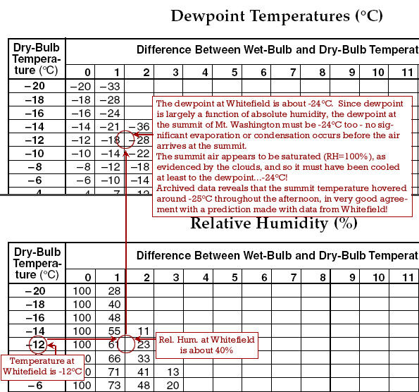
 The cold, cP air that covered the region last weekend presented some pretty interesting opportunities to explore some of the atmospheric phenomena we study in earth science classes. When a colleague in New Hampshire sent the image of Mt. Washington ("Home of the World's Worst Weather), I began looking at data from the area where the photo was taken, and from the summit of Mt. Washington. What I soon realized was that in this fairly uniform and stable air mass, I could predict the temperature at the summit based on observations at the location where the photo was taken. That night, temperatures on the summit dropped to -31°C - cold to be sure, but not as cold as it might have been.
The two exercises below will help you understand what was going on.
Mt Washington, NH Weather Part 1 and Part 2 (solution to Part 1)
See the solution to Part 1 only if you are stuck (or want to check your answers). You can email if you want an explanation of Part 2.
Tomorrow, I'll post another quick exercise involving the heating and cooling of descending and rising air.
No comments:
Post a Comment